
The Froggies welcome you.

Activities
Road cycling
Sunday july 25th : Like a purebred galloping across the marshes.
Monday july 26th : Labelled local products - whelks, apples and carrots.
Tuesday july 27th : At the end of the world, where Nature is wild and wonderful.
Wednesay july 28th : Heading North, where the road falls off into the sea.
Thursdayjuly 29th : A Vauban-style picnic
Friday july 30th : Feel free to ride along the heroes’ beaches!
Saturday july 31st : The coast of the Windward… no… the windswept Islands!

Mountain-Biking : 7 different ways to see the sea
During the week you will discover different aspects of the Cotentin peninsula with one promise: a different sea view every day!
You will be cycling for 7 days on a wide variety of courses, with technical routes sometimes, designed by local mountain-bikers eager to make you discover their favourite playground.
You will have a choice of routes between 30 and 80km and of up to 1 500m ascending elevation but all of them will lead to sea views. You will enjoy breathtaking landscapes where nature is wild and well preserved.

Sunday july 25th : From Flamanville to Le Rozel : two capes, no escape !
Monday july 26th : Cherbourg fortress
Tuesday july 27th : Ireland? Scotland? No, only the Norman version of the end of the world!
Wednesay july 28th : The Val de Saire where the sea meets the bocage and where vegetables are grown.
Thursday july 29th : The bay, fortified by Vauban
Friday july 30th : Freedom was brought by air and by sea… and where, historically, La Madeleine beach became Utah Beach.
Saturday july 31st : Portbail (out) package!
"Cyclo - Découverte"
| Sunday 25th | Monday 26th | Tuesday 27th | Wednesday 28th | Thursday 29th | Friday 30th | Saturday 31st | |
| The Côte des Isles (60 p.) | X | X | |||||
| The Hague area (45 p.) | X | X | |||||
| Cherbourg and the Castles (60 p.) | X | X | |||||
| Landing beaches and Cotentin marshes (60 p.) | X | X | |||||
| Norman Bocage (60 p.) | X | X | |||||
| Picnic in la Hougue (60 p.) | X | ||||||
| The Val de Saire (60 p.) | X | X |
The Côte des Isles
63 km (520m ascending elevation)
Starting point : Saint-Sauveur-le-Vicomte
After the visit of Saint-Sauveur-le-Vicomte castle and abbey (BPF 50) you will head west down to the sea, stopping at Canville-la-Roque to see the fresco representing the legend of the unhung hangman on the way of Saint James of Compostela.
After Portbail, where you can see the only Paleo-christian baptistery north of the Loire river, you will cross the coastal plain where growing vegetables is the leading activity.
Then you will ascend to Carteret signal station.
On the way back, you will see a windmill and the final part of the route will use a green track situated on the former Cherbourg-Coutances railway line.

Cherbourg and the castles
54km (576m ascending elevation)
Starting point: Le Theil
After seeing a spinning mill over the Saire river, you will see no fewer than 4 castles today!
Then you will ascent to a scenic viewpoint overlooking Cherbourg bay.
You will cycle along the coast for about 10km before taking to the narrow lanes of Cherbourg with views over the Redoutable submarine and the former transatlantic terminal port from where the Titanic once left.
On the way back you will see the Ravalet castle and its magnificent park and the Cotentin bocage.

The Hague area
47km (839m ascending elevation)
Starting point: Beaumont-Hague
This day in the Hague area is a not-to-be-missed event. You will see the houses of the painter Jean-François Millet and the poet Jacques Prévert.
You will also have the opportunity to discover the Tourp Manor (a former farm transformed into a Heritage centre), the Hâble harbor in Omonville-la-Rogue and Port Racine (the smallest harbor in France)
In Auderville (BPF 50) you will see Goury lighthouse, surrounded by the sea. Imagine the spectacular view when winter storms rage with gigantic waves
At the Nez de Jobourg (Jobourg’s nose) you will discover the highest cliffs in Europe which culminate at 128m above sea level.

Picnic in La Hougue
36+23km (460m ascending elevation for the outward trip)
Starting point: Valognes
Today the discovery ride is on the way to the traditional Thursday picnic and the return trip uses the short bike circuit.
You will go to the north entrance of Alauna la Romaine to see the ruins of the bas Castelet thermal baths, dating back two millennia.
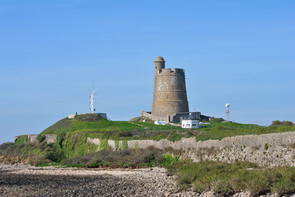
On the way, you will admire local heritage buildings and also the wonderful view over Tatihou island and La hougue Vauban towers (listed by UNESCO world heritage since 2008).
Before joining the other riders you will make a little detour via the lovely village and harbor of Saint-Vaast-la Hougue (BPF50)
The Val de Saire
57km (423m ascending elevation)
Starting point: Quettehou
Off you go for a long trip which takes you to a replica of Lourdes grotto, a castle with glazed tiles roofs as in Burgundy, a road lined with fir trees like in the Vosges, and a church with a painted ceiling like in the Sistine Chapel.
You will discover the Marie Ravenel watermill, the Gatteville lighthouse, the Houguet manor and the Cabourg manor in Réville.
The Val de Saire is a haven of peace and tranquility epitomized by Barfleur harbor.

The Norman bocage
65km (335m ascending elevation)
Starting point: Valognes
Let’s taste a wide variety of landscapes between bocage, marshes and seashore.
You will also navigate between the two World Wars when visiting Servigny castle in Yvetot-Bocage (where the surrender of Cherbourg harbor was signed in 1944), the German cemetery in Orglandes, the German batteries in Azeville but also the last visible airship hangar built in reinforced concrete during WWI.

Landing beaches and Cotentin marshes
66km (241m height difference)
Starting point: Neuville-au-Plain
This will be the flattest circuit of the week. First you will see monuments linked to WWII. Then you will ride across the marshes where you will discover typical local houses made of stones and “masse” (mud).
After lunch, you will visit Utah beach museum and, on the way back, you will see the Leclerc monument and Sainte-Mère-Eglise, the emblematic village of the D-day landing.

Rambling
| Day | Start | Lunch | Finish | Distance | D+ |
| Sunday july 25th | Pont l'Abbé | "Point d'accueil" de Picauville | 9km | 53m | |
| "Point d'accueil" de Picauville | Pont l'abbé | 17.8km | 94m | ||
| Monday july 26th | Station SNSM de Goury | Bring your packed lunch | Port Racine | 8km | 58m |
| La Crecque | 15km | 430m | |||
| Tuesday july 27th | Sémaphore de Flamanville | "Poin d'accueil" d'Urville-Hague | Plage de Siouville | 12km | 102m |
| Ferme du Tourp | Bring your packed lunch | Plage d'Urville | 14.2km | 155m | |
| Wednesday july 28th | Gatteville (place) | "Point d'accueil" de Montfarville | Montfarville | 10km | 27m |
| Anse du Brick | "Point d'accueil" de Saint-Pierre-Eglise | Moulin de Marie Ravenel | 20km | 270m | |
| Thursday july 29th | La Pernelle | La Hougue (UNESCO) | 13km | 140m | |
| Friday july 30th | Audouville la Hubert | "Point d'accueil" de Ste-Mère-Eglise | Sainte-Mère-Eglise | 12km | 57m |
| Ravenoville | Bring your packed lunch | Quinéville | 18km | 138m | |
| Saturday august 31st | Carteret | "Point d'accueil" de Portbail | Portbail | 13km | 30m |
| Sémaphore de Flamanville | Bring your packed lunch | Cap du Rozel | 15km | 269m | |
Registration
The registration/offering of accommodation will open on january 15th 2021.
For British citizens arriving in Cherbourg by ferry and those arriving in Caen by train, all the registration documents will be obtained in Valognes. No need to go to Sainte Mère Eglise first.
Where to stay
Federal accomodation
Federal campsite
The federal campsite is very close to Valognes. You are accommodated less than 2km from the town centre and the starting point of the rides. A small road, reserved only to cyclists during the Federal Week, will take you safely to Valognes town centre.
The campsite will be set up in a field surrounded by hedges. Individual tent or camper van pitches will be available. Temporary sanitary facilities (toilets, outdoor sinks and basins, hot water showers). Possibility to charge your bike batteries. Bar, snacking and a little open-air market on site.
Collective accomodation
As usual, local boarding schools will offer accommodation. They are situated in the town centre but the number of beds is limited. Other collective accommodation options are available within 10 to 15km. First-come first-served policy!
Accomodation in private homes
The volunteer workers in charge of accomodation for the Federal Week have started looking for houses with guests rooms, if possible within 15km of Valognes, but, because the sea is always very close, the accomodation might be situated anywhere in the (small) Cotentin area.
You have got 2 options:
- renting rooms in private houses
- finding a place to park your camper van or caravan.
This type of accommodation is limited in number.
Accommodation in Premium glamping tents :
The COSFIC offers accommodation in a pop-up hotel composed of 20 lodges of 20m2 each accomodating up to 4 people.
The top quality tents will be set up in a space near the Permanence and organized around a common space where people will be able to meet and spend time in a friendly atmosphere.
The toilets will be those of the rugby club house.
More information available on the website here
Professional accomodation
If you want to be accommodated in a professional structure follow this link to discover various options selected for you by “Manche Tourisme” (local tourist information centre)
Useful information
Getting to Valognes
By bike
You can choose any roads except the RN13. It is a 2x2 lane road, not appropriate to cycling.
By ferry
You can choose any roads except the RN13. It is a 2x2 lane road, not appropriate to cycling.
By rail
Valognes railway station is situated on the Paris-Cherbourg SNCF (French Railway Company) line.
When coming from Rouen or the Pays de la Loire area you will have a connection in Caen railway station.
When coming from Rennes you will have a connection in Lison railway station.
By road
From Caen take the RN13 (a free 2x2 lane road) towards Cherbourg.
From Rennes, take the free A84 motorway towards Caen, then the RN174 (a free 2x2 lane road) towards St Lô and finally the RN13 (a free 2x2 lane road) towards Cherbourg.
Map of Valognes
* Campsite : Hameau Gallis, 50700 Yvetot-Bocage (pink zone on the map).
* Federal village : Complexe sportif Marcel Lechanoine, allée du stade, 50700 Valognes (green zone on the map).
* Entertainment : address still to come.
* Shuttle service : Campsite – town centre – federal village.
* Bike lane : Campsite – town centre – federal village (in blue on the map).
* Day car-park : around the federal village (in yellow on the map).
* Collective accomodation :
- Lycée Henri Cornat, rue Henri Cornat, 50700 Valognes
- MFR, 70 rue des Religieuses, 50700 Valognes
* Collective catering :
Salle omnisports Gilbert Février, 50700 Valognes
A brief history
The earliest traces of human settlement discovered in the Cotentin peninsula by archaeologists date back to Neanderthal man!
Much later, during the 1st century BC, the Cotentin was in a similar situation to Asterix's village. But unfortunately Obelix was not there and things were to turn out much worse than they did for their creator Uderzo. The Gauls made a heroic stand against the Roman legions, but eventually gave in during a final battle at Mont Castre.
It was also at this time that Alauna, ancient name of Valognes, gained considerably in importance, as testified by the roman bath ruins which can still be seen today. There was also a theatre which could accommodate almost 3,000 spectators!
In the 9th and 10th centuries, the peninsula was under threat by the Bretons and invaded by Viking pirates. The Vikings decided to settle in the region and left a deep mark on its cultural identity.
From 1035 onwards, one of the Cotentin's most glorious chapter’s unfolded: the epic story of William the Conqueror! In that year, at eight years of age, he became the Duke of Normandy.
In 1047 he quashed a rebellion by the barons of Cotentin and Bessin and so established his authority in our region.
After 1066 and the Conquest of England, while the port of Barfleur was developing, the Cotentin enjoyed new prosperity.
Two other sagas would mark the history of the territory. Firstly that of the Royal Mirror Glass Factory situated where La Glacerie now stands which in the 17th century, provided the mirrors for the Palace of Versailles, the Louvre and Fontainebleau!
Secondly, barely 50 years later, began the most colossal building project of the era: the construction of the Cherbourg seawall. It would take nearly a century to finish building one of the most strategic sites in France.
I WAS DETERMINED, Bonaparte himself soon wrote TO REPEAT THE WONDERS OF EGYPT AT CHERBOURG
He would not have time, but Cherbourg had acquired a taste for oversized projects...
The beginning of the 20th century was marked by the construction of the transatlantic terminal, while a few decades later on the other side of the port, the first nuclear submarines saw the light of day at the Cherbourg arsenal.
Nous suivre sur Facebook.


Contactez-nous
COSFIC 2021 - BP41 / 50700 VALOGNES